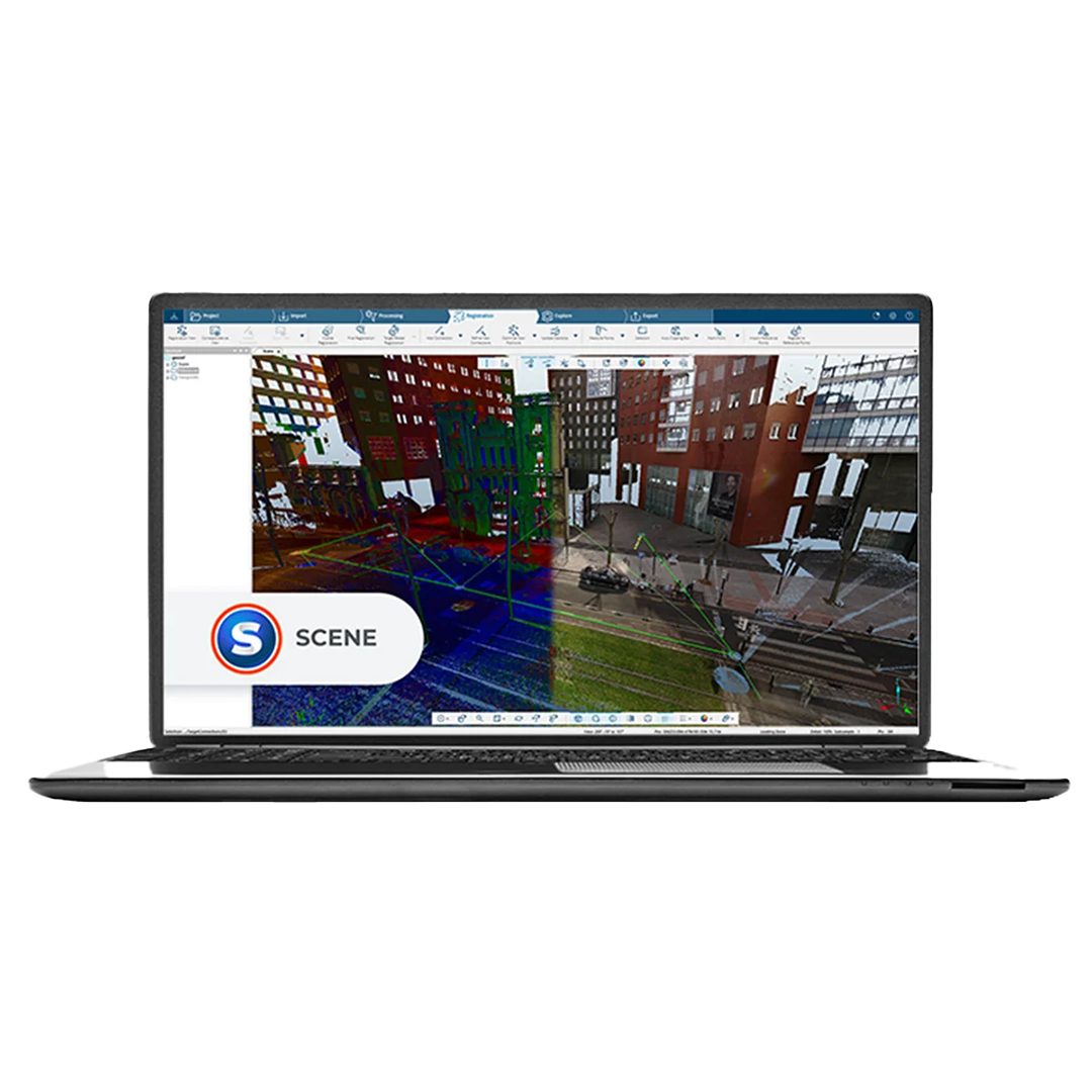
직관적인 3D 포인트 클라우드 시각화
![]()
FARO Scene
Software
간소화된 대화형 및 하이브리드 스캔 정합을 위한 궁극적인 솔루션을 발견하세요
강력한 대화형 & 하이브리드 정합
대화형 정합과 하이브리드 정합이라는 두 가지 필수 기능으로 SCENE의 강력함을 경험하세요. 대화형 스캔 정합을 통해 사용자 친화적인 인터페이스로 개별 스캔을 원활하게 연결하고 연결 방식을 제어할 수 있습니다. 하이브리드 정합으로 클라우드 투 클라우드, 타겟, 측량 제어를 필요에 맞는 조합으로 활용하세요.
SCENE으로 스캔의 진정한 잠재력을 발휘하세요.
쉽고, 직관적이며, 범용 호환
모든 FARO 스캐닝 솔루션 및 타사 레이저 스캐너와 호환되도록 설계된 이 소프트웨어를 사용하면 스캔 데이터를 쉽게 처리하고 관리할 수 있습니다. 자동 타겟 인식, 스캔 정합 및 검증과 같은 기능으로 데이터 관리의 최적 효율성을 달성할 수 있습니다.
자동화된 타겟리스 및 타겟 기반 스캔 포지셔닝의 강력함을 활용하여 빠르고 편리하게 놀라운 결과를 생성하세요. 지루한 수동 프로세스와 작별하고 풀 컬러의 고품질 데이터를 만나보세요.
CAD로 내보내기 또는 가상 현실에 몰입
SCENE의 효율적인 스캔 데이터 준비 기능으로 데이터를 신속하게 평가 및 처리하고, 정밀한 측정을 수행하며, 매력적인 3D 시각화를 생성할 수 있습니다.
스캔을 다양한 포인트 클라우드 및 CAD 형식으로 번거로움 없이 내보내세요. SCENE의 가상 현실(VR) 뷰를 사용하면 캡처된 데이터에 몰입하여 완전히 새로운 수준의 평가와 탐색을 경험할 수 있습니다.


Unleash the Full Potential of the Orbis Mobile Laser Scanner
Business Value of the Orbis Mobile Laser Scanner
Simplify your scanning process
Just a click and a walk is all it takes to collect valuable data effortlessly. Designed for usability, Orbis streamlines surveying tasks for everyone, no matter the industry. Now you can capture data in places you never thought possible before. Discover the ease and efficiency of Orbis.
Unlock Powerful Insights
Experience the next level of data capture with our cutting-edge 3D technology. Elevate your understanding and gain valuable insights into your projects. Stay ahead of the curve in dynamic industries like construction, by capturing data more frequently and comprehensively. Our user-friendly and portable solution seamlessly integrates into any job site, providing a constant stream of fresh insights to transform your decision-making and collaboration. Revolutionize your projects and deliverables with our synergy-driven approach.
Peace of Mind One-Year Warranty
At FARO, quality is at the core of everything we do. We meticulously design, build, and test our products to ensure top-notch performance. That's why we confidently offer a one-year warranty with every purchase, because we believe in the durability and reliability of our hardware. But that's not all - we also provide affordable extended service plans, so you can protect your investment and avoid any unexpected expenses. Trust in our commitment to your satisfaction and enjoy the peace of mind you deserve.
Ultimate All-in-one Mapping Solution
Compatible with a range of accessories including a monopod, car mount, backpack, and cradle, this versatile device is perfect for capturing every kind of terrain, from stationary scans to expansive landscapes. From mineshaft exploration to outdoor adventures, the Orbis has you covered. Discover the endless possibilities and take your mapping to the next level.
FARO Obris Mobile Performance
Hybrid
Reality
Capture with
FLASH
Technology
Upgrade your mobile scanning capabilities with Hybrid Reality Capture, featuring our cutting-edge FLASH Technology. Experience unprecedented mobile and stationary scanning accuracy and detail with Orbis, the ultimate scanning solution. Achieve unmatched speed, data clarity, and precision all in one comprehensive package. Elevate your scanning game to the next level with FARO's Hybrid Reality Capture and FLASH Technology.
Experience the Speed of the Future
Orbis Mobile
Scanning
Technology
Unleash
the power of
rapid data
capture with
Orbis. Our
cutting-edge
mobile scanning
technology
revolutionizes
project
timelines,
allowing you to
acquire accurate
spatial data at
an unprecedented
pace. Say
goodbye to
traditional
laser scanning
and hello to
Orbis, the
solution that
will propel you
ahead in today's
fast-paced
world.
GeoSLAM's Cutting-Edge SLAM Algorithm
Unlock unparalleled results with GeoSLAM's revolutionary SLAM algorithm. Trusted by top professionals worldwide, our algorithm, powering the exceptional Orbis, has stood the test of time in the toughest of conditions for over a decade. Continual innovation fueled by valuable customer feedback ensures our algorithm consistently exceeds expectations, transforming projects across various industries.
FARO Orbis Mobile Features
Effortless Scanning with Orbis
Weighing only 3.6kg, with the datalogger and battery included, Orbis is the ultimate tool for swift and hassle-free scanning of vast areas. No more cumbersome setups required!
Unparalleled Accuracy
Achieve a precision of 5mm with mobile scans and an impressive 2mm with stationary Flash scanning. Orbis is the top choice for those seeking ultimate accuracy in mobile scanning solutions.
Indoor and Outdoor Mapping
Whether you're working inside or exploring the great outdoors, Orbis has got you covered with a remarkable range of up to 120 meters. Say goodbye to limitations and embrace limitless possibilities with Orbis.
Accurately
Map the Toughest
Environments
Experience the unrivalled capabilities of Orbis - a cutting-edge solution crafted to conquer the most challenging environments. From underground mines to dense forests and construction sites, Orbis seamlessly maps any environment with precision and ease.
AEC, Mining and Geospatial Applications
Maximize Mining Efficiency and Safety
Put safety first. Orbis reduces risk to human life by minimising exposure to hazardous environments. With Orbis, you can confidently navigate your mine while safeguarding your team.
Capture stockpile volumetric calculations, track production progress, analyze convergence, and inspect vertical shafts with ease. Our impressive rate of data capture and range capabilities empower you to make informed decisions and optimise your mining operations.
Unlock the potential of your mine with Orbis. Experience unbeatable efficiency, maximize returns on your investment, and pave the way for a successful mining future.
Streamline AEC Data Capture and Collaboration with Orbis
Stay ahead of the competition with our cutting-edge solution for AEC projects. Orbis delivers fast and precise data capture, enabling you to track progress effortlessly on a monthly, weekly, or daily basis. Say goodbye to disruptions on the job site and hello to seamless analysis.
The Ultimate Data Capture Solution
Ideal for geospatial workflows and various applications, Orbis offers unmatched flexibility and precision. No matter the task at hand, whether it's dynamic scanning or meticulous Flash scans, our versatile solution delivers outstanding results every time.
Don't settle for anything less than the best. Choose Orbis and experience the synergy of speed, accuracy, and convenience.
Say hello to a new era of data capture!
Performance Specifications
| Performance Specifications | ||||||||
| Range | 120m | |||||||
| Points Per Second | 640,000 | |||||||
| Field of View | 360° x 290° | |||||||
| No. of LIDAR channels | 32 | |||||||
| Camera | Full 360° image of 8M pixels captured every second | |||||||
| Mobile Scanning | ||||||||
| Precision1 | 5mm | |||||||
| Trajectory & Mapping | Robust SLAM powered by GeoSLAM technology | |||||||
| Settings | Automatic Standard and Preset Processing Environments | |||||||
| Stationary Flash Scanning | ||||||||
| Precision1 | 2mm | |||||||
| Duration | 15 sec. including color | |||||||
| Resolution | 19M points (13mm @ 10m) | |||||||
| Registration | Real-Time and Fully Automatic with GeoSLAM technology | |||||||
| General Features | |||||||||||
| Environment | Indoor and Outdoor | ||||||||||
| Laser Class2 | Class 1, Eye Safe | ||||||||||
| Weight | Scanner: 2.10kg, Datalogger: 0.95kg, Battery: 0.55kg | ||||||||||
| Protection Class | IP 54 | ||||||||||
| Transport Case Dimensions | 500mm x 625mm x 250mm | ||||||||||
| Operating Temperature | 0° to +40°C | ||||||||||
| Manufacturer Warranty | 1 Year | ||||||||||
| Data | Point clouds with Intensity and Color, 360° Images, Trajectory | ||||||||||
| Raw Mobile Data Size | 350MB/min uncompressed | ||||||||||
| Flash Scan Data Size | 125MB | ||||||||||
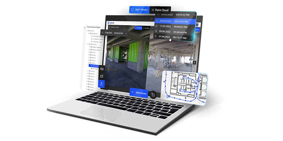
| Desktop Processing | FARO Connect for Mobile and Flash Scans, FARO Scene for Advanced Registration | ||||||||||
| Cloud Processing | Fully automated with FARO Sphere XG | ||||||||||
| Output |
Mobile scan:
E57, LAS,
LAZ, PLY,
TXT Flash scan: E57 |
||||||||||
1 Given as one sigma | 2 Under IEC EN60825-1 | Specifications are subject to change without prior notice
관련 제품
Sphere XG
FARO Sphere XG는 안전한 싱글 사인온 프로세스(SSO)를 통해 리얼리티 캡처 애플리케이션 및 고객 지원 도구 전반에 걸쳐 중앙 집중식 협업 경험을 제공하는 디지털 리얼리티 플랫폼입니다.
Scene
FARO Scene는 데이터 처리 및
스캔 정합이 이루어지는 곳입니다. 3D SCENE
소프트웨어를 사용하면 실제 물체와 환경의
놀라운 3D 시각화를 생성하고 다양한 형식으로
데이터를 내보낼 수 있습니다.
Connect
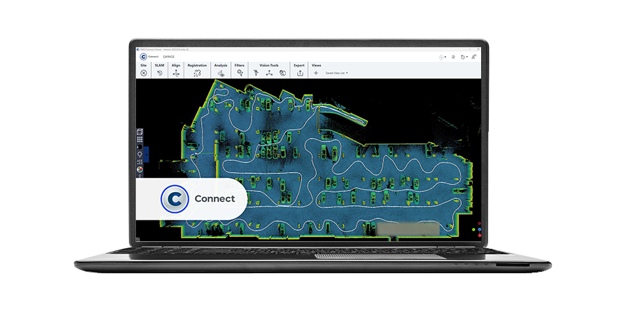
FARO Connect로 원활한 생산성을 경험하세요.
FARO Orbis에서 캡처한
데이터 전용으로 설계된 최첨단 LiDAR
소프트웨어입니다. 효율성을 높이고
전에 없던 새로운 가능성을 열어보세요.